|
|
| EVERGREEN ARTICLES: |
| Cootes Store |
| The Landscape |
| The Way It Was |
| The School |
| Hunting & Fishing |
| Poems |
| First Graders |
| The Students |
| PHOTOS: |
| People |
| Cootes Home |
| Cootes & Co. |
| Tintypes |
| Family Bible 1 |
| Family Bible 2 |
| UPDATE: | |
| Flood of 1936 | |
| Cootes Store 1999 | |
| Chimney Rock 1999 | |
| Gap Rock 1999 | |
| GENEALOGY: | |
| Samuel Cootes | |
| Cootes Deeds (1821 to 1881) | |
| 1885 Map | |
| Links | |
|
|
|
|
|
|
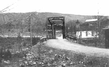
| HISTORY OF THE ROAD FROM
BROADWAY TO FT. SEYBERT W. VA. Zack M. Turner 15 The history of this road begins far back in colonial times. In 1763 history tells us of an old Indian trail or road leading from the old Indian fields, now Hardy County W. Va. across the mountain south to the head waters of the north branch of the Shenandoah River. It then followed this stream for miles down through Brocks Gap, then southeast by way of what is now Singers Glen, Big Spring at Harrisonburg and on east to the Massanutten Mountain. About four miles of this trail from Fulks Run to Brocks Gap is in the Ft. Seybert road. The next mention of this road was in 1757, when two hundred Englishmen under Captain Brock were sent from Winchester to the relief of Ft. Seybert. They passed through Brocks Gap and followed the old trail reaching Ft. Seybert too late, the Indians having massacred the white people in the fort. An official document tells us that in 1778 the county of Augusta ordered a road to be marked off and laid out leading from the Indian trail above mentioned at now Fulks Run postoffice west up Sugar River, later Stultz River, now Dry River. It followed an Indian trail to the foot of the Great North Mountain. Then it led northeast to the top of the mountain. It followed the top to Haul Spring. There it leads north, then down the mountain to the South Fork Valley and across the river to where Ft. Seybert postoffice now stands. Old documents of 1791 called this road The Wagon Road or New Dug Road. The next we hear of this road is in 1845 when a new survey is made and a new road built leading up the mountain between the old Indian trail and the road of 1778. This crossed the mountain at a much lower place in the mountain. It is a shorter route and a much better grade. This road was greatly improved along Dry River down the main Brocks Gap Road to Fulks Run postoffice. The lower end of this road of about eight miles from Fulks Run to Broadway, was along the river. It crossed the river at a number of places thus making traveling difficult and dangerous. In 1880 Mr. Ulrich Wittig was instrumental in having this road changed so that the river is only crossed in two places between Broadway and Dovesville. In 1912 a new road was undertaken by the state of Virginia, the Board of Supervisors and citizens of Plains District. A joint fund of about $75,000 was raised. Under the supervision of state officials and the Board of Supervisors, the work was commenced at Broadway. The work continued for three years when twelve miles were completed. Work then stopped. This road is a waterbound macadamized road with a bed of twenty feet wide. The macadamizing is twelve feet wide. The grade is about one and a half percent. The survey of this road leads west through the village of Cootes Store, Fulks Run and on west up Dry Run. It crosses the mountain passing through the Turner land south of the Settlement and down Big Ruff Run to the valley, then to Ft. Seybert. This road has more heavy hauling on it than any other road in the state of Virginia. It has toll gates and the fund is used to pay off bonds issued for its construction. Without this road the Brocks Gap country would be cut off from the main valley. |